Introduction to forestREplot
Resurveys of historical vegetation plots are invaluable to document patterns of change in community composition and diversity. They are also useful to better understand impacts of multiple and interacting global-change drivers.
The relevance of resurveys is particularly high for communities exhibiting slow dynamics, such as herb layers in temperate forests. Furthermore, herb layers in temperate forests typically comprise a large fraction of the vascular plant diversity and are known to be strongly affected by various global-change drivers, including past land use, increased atmospheric deposition and changing management.
The importance of long-term records for biodiversity research was recently stressed in Nature.
Gaining in-depth insights in the patterns and processes of change therefore requires many plots sampled over large environmental gradients. However, at present no large database exists that brings together forest understorey resurvey data collected at different locations and occasions across the temperate biome in a harmonized way.
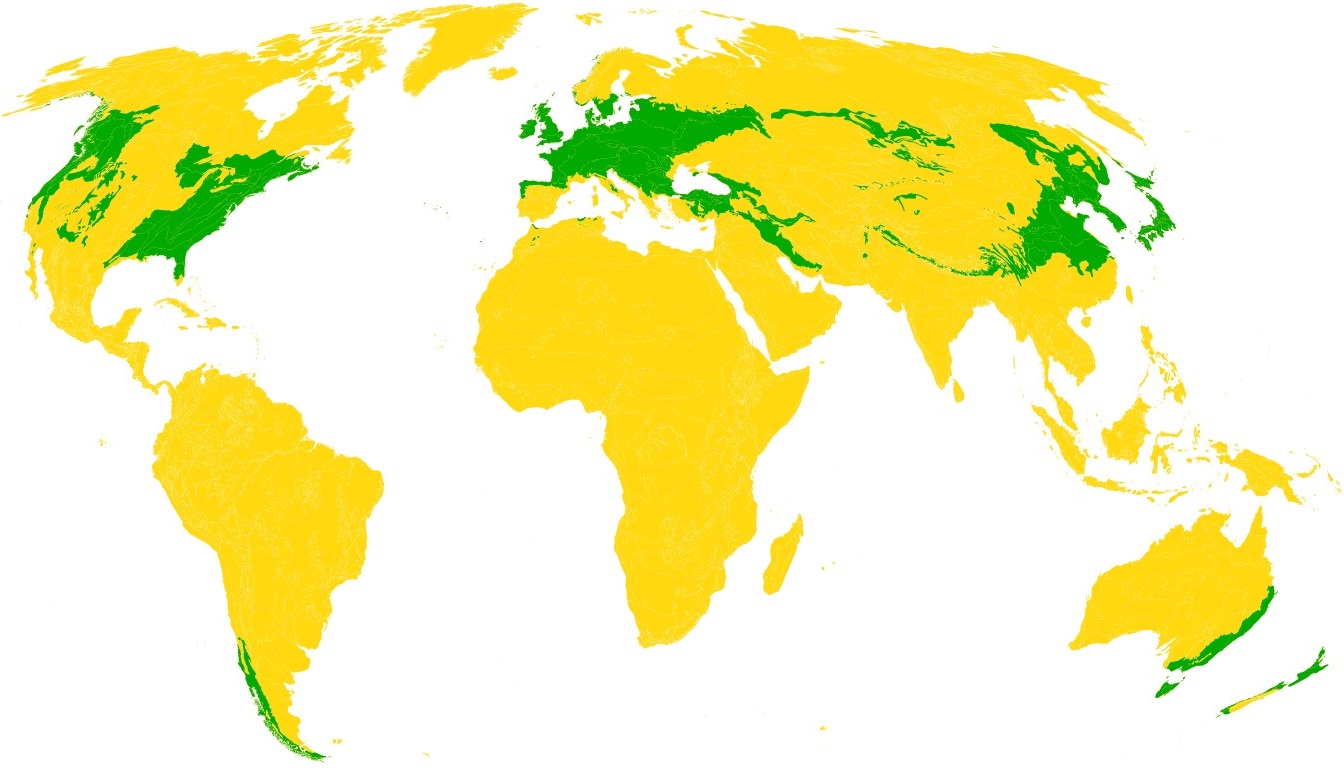
Map of temperate broadleaf, conifer and mixed forests from Olsen et al. (2001) Bioscience, 51, 933-938 (Mollweide projection).
forestREplot aims to assess shifts in forest plant communities around the globe. To be included in the forestREplot database, data need to fulfil the following criteria:
- Plots are located in temperate forest worldwide (see map above)
- Plots are located in forest locations with a known land-use history (i.e. ancient or recent forest)
- Plots are located in semi-natural and natural forests according to the FAO definitions (e.g. exclude fertilized, heavily managed plantations)
- Number of plots and time span: about 20 plots per dataset and about 20 years between the oldest and most recent survey are the minimum requirements
- Plot size varies between 1 m2 and 1000 m2
- Plots should not be pseudoreplicates, i.e. distributed over a sufficiently large area
- GPS coordinates of each plot are available
- Records of all vascular plant species (presence/absence or cover/abundance) are available for each plot; at least for the herb layer, but preferably also for the shrub and tree layers
- Between the two surveys, no human-induced conversion to stand types no longer in line with the natural or semi-natural forest criteria has taken place (e.g. clearcutting and replanting with conifers on a site naturally dominated by broadleaves)
Data overview Data content and policy Most common species
We welcome paper proposals using the forestREplot database. If you interested to start a study under the conditions explained in the Data content and policy-document and Paper proposals-document, please fill in this template and email this to the management committee.